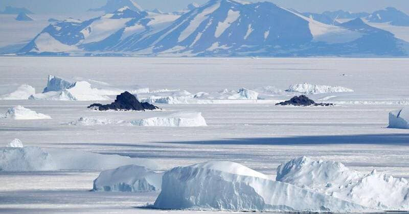
Scientists have uncovered how Antarctica's ice sheet could form when Earth was around 5C warmer. Photo: AP PHOTO
While it once was temperate and lush, Earth's southernmost continent Antarctica froze over about 34 million years ago, covered by an ice sheet that today is up to around 5km thick.
Subscribe now for unlimited access.
or signup to continue reading
EOFY SAVE 50%
All articles from our website
& app
The digital version of
Today's
Paper
Crosswords, Sudoku and Trivia
All other
in your area
By contrast, the planet's northernmost realm, the Arctic region, did not freeze over for another 25 million years.
This polar asymmetry long has puzzled scientists, but researchers now may have solved the mystery.
They assessed the Antarctic region's topography and used computational models to reconstruct how the surface evolved over many millions of years. They found a powerful geological process drove the renewed uplift of a mountain range in eastern Antarctica that eventually passed an elevation threshold crucial for letting mountain glaciers form and expand and for permanent ice to take hold.
The result was the appearance of the vast East Antarctic ice sheet at a time when global temperatures were around 5C warmer than today. That left the South Pole with an ice cap long before a long-term global cooling trend enabled an ice cap to become established around the North Pole.
The East Antarctic ice sheet was in place by the start of a chapter in Earth's history called the Oligocene epoch, which followed the Eocene epoch.
Antarctica remained connected to Australia and South America for tens of millions of years. (EPA PHOTO)
Antarctica once was part of a Southern Hemisphere supercontinent called Gondwana that also included landmasses that are now Africa, South America, Australia, Arabia and the Indian subcontinent.
As part of a process called plate tectonics involving the inexorable movement of continent-scale plates on the planet's surface, these landmasses eventually separated and crept toward their current locations.
"Our study shows that an ancient geological process that started more than 160 million years ago during the continental break-up of Africa and Antarctica and played out over many tens of millions of years determined when and where Earth's major ice sheets could form during the Eocene-Oligocene transition, approximately 34 million years ago," said geoscientist Thomas Gernon of the University of Southampton in England, co-leader of the study published in the journal Science.
This transition marked the change from Earth's warm "greenhouse" climate to the current cooler period, Gernon said.
Antarctica remained connected to Australia and South America for tens of millions of years after Africa drifted away, eventually separating from those as well.
The geological process Gernon mentioned is a phenomenon called mantle waves - slow-moving disturbances deep within the Earth that are triggered during continental break-up.
"These waves can remove dense rock from the underside of tectonic plates, making the continents lighter and causing them to rise, ultimately forming high ground such as plateaus and mountain ranges," Gernon said.
When these mantle waves moved under Antarctica, they caused the formation of a large plateau topped by the Gamburtsev Mountains, a range in the central part of eastern Antarctica. While these mountains reach up to about 3390m tall, the range is now buried under the world's largest ice sheet.
The researchers said the erosion and uplift caused by mantle waves gradually pushed the landscape to elevations high enough for ice to stabilise, even at a time of a warm global climate.
"Our study underscores the importance of the interaction of changing climate and changing topography," University of Southampton geoscientist and study co-leader Thea Hincks said.
Australian Associated Press
More from World News

As it happens
Breaking news alert
Be the first to know when news breaks.


